 |
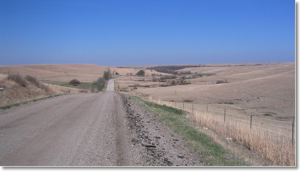
| April 13, 2006 ... Two hundred and twenty miles in the saddle. With the weather so unusually warm, and things being slow work-wise, decided to get out of Wichita for the day and do a solo ride. Being alone, made sure I was ATGATT (chest protector, knee and shin guards, forearm and elbow protectors, helmet, leather gloves, throat protection, hearing protection, GPS, cell phone, extra water). I'd be way out there and alone .... and needed to give myself good odds of getting back in one piece. My route would be almost entirely off-pavement. Leaving west Wichita, I rode up to Sedgwick, then further on to the outskirts of Newton. Taking seldom used roads, I rode east to Elbing, then north to a point just south of Peabody. Taking a dirt road that paralleled US 50, started my entry into the Flint Hills, ending up just south of Florence. Things really started to get pretty when I entered sparsely populated Chase county. What a shock to discover that for the first time ever, Chase county is putting up road signs! (so that's what this road is named!) Will take some getting used to ... but should make our references all the more easier. Once into Chase county, started seeing the wild turkeys. No big flocks, just singles and pairs ... but at least a dozen according to my log. Another detail that struck the senses was the flowering of the wild plum bushes, scenting the air with a fragrance that could best be described as a cross between the smell of cloves and nutmeg. Rode east to Cedar Point to photograph the old mill, then rode south and east to arrive at the Coyne Creek road (minimum maintenance). Very easy to traverse this time ... no recent rain meant no difficult water crossings (the road bed is the creek bed in places). Worked my way over to Bazaar, then rode south along the Sharps Creek Road (open range). Being a solo presence, the cattle were little more than curious, in contrast the skittishness they exhibit when confronted with a "wolf pack" of riders. Continued riding south until I hit the Madison Road (open range again). Here, the prairie had been recently fired, and was free of cattle. I was able to pick-up speed and make Texaco Hill in quick fashion. Riding down to Teterville, and then turning to do the east-west leg to Cassoday, realized the weatherman had lied. Where forecasts had called for 15-20 mph wind speeds, I was getting hammered by a crosswind at least twenty miles per hour more intense. On loose gravel, it made the front wheel do a fair amount of skating at speed, so I slowed way down to keep my adrenaline at manageable levels! At the slower speed, was able to enjoy some prairie fires that were burning their way south into the wind. Arrived at the Cassoday Cafe with ten minutes to spare before closing time, and had a hearty late lunch. Although it was ninety-five degrees outside, the cafe hadn't switched their A/C on yet, and I discovered that the interior heat (same as outside) equated to a lot of sweating while eating (another ice tea, please)! Leaving Cassoday, worked my way back to Wichita in a zigzag pattern along Butler county's numerous riparian forest roads (Walnut and Whitewater river valleys) ... it kept me out of the intense wind, and I had no cars or pickup trucks to contend with. Once back in Sedgwick county, it became an interstate sprint to home with a cold beer waiting in the fridge. Great scenery and riding conditions, with a healthy dose of wind to keep me alert. Just what the doctor ordered! ..... rb Click on a thumbnail to view a larger image. Use your browser's "back" button, or the "left" arrow in the navigation bar to return to this page. |
![[IMAGE]](131-3119_IMG.jpg) ![[IMAGE]](131-3120_IMG.jpg) ![[IMAGE]](131-3121_IMG.jpg) ![[IMAGE]](131-3123_IMG.jpg) ![[IMAGE]](131-3124_IMG.jpg) ![[IMAGE]](131-3125_IMG.jpg) ![[IMAGE]](131-3126_IMG.jpg) ![[IMAGE]](131-3127_IMG.jpg) ![[IMAGE]](131-3128_IMG.jpg) ![[IMAGE]](131-3129_IMG.jpg) ![[IMAGE]](131-3130_IMG.jpg) ![[IMAGE]](131-3131_IMG.jpg) ![[IMAGE]](131-3132_IMG.jpg) ![[IMAGE]](131-3133_IMG.jpg) ![[IMAGE]](131-3134_IMG.jpg) ![[IMAGE]](131-3135_IMG.jpg) ![[IMAGE]](131-3136_IMG.jpg) ![[IMAGE]](131-3137_IMG.jpg) ![[IMAGE]](131-3138_IMG.jpg) ![[IMAGE]](131-3139_IMG.jpg) |
|
|